
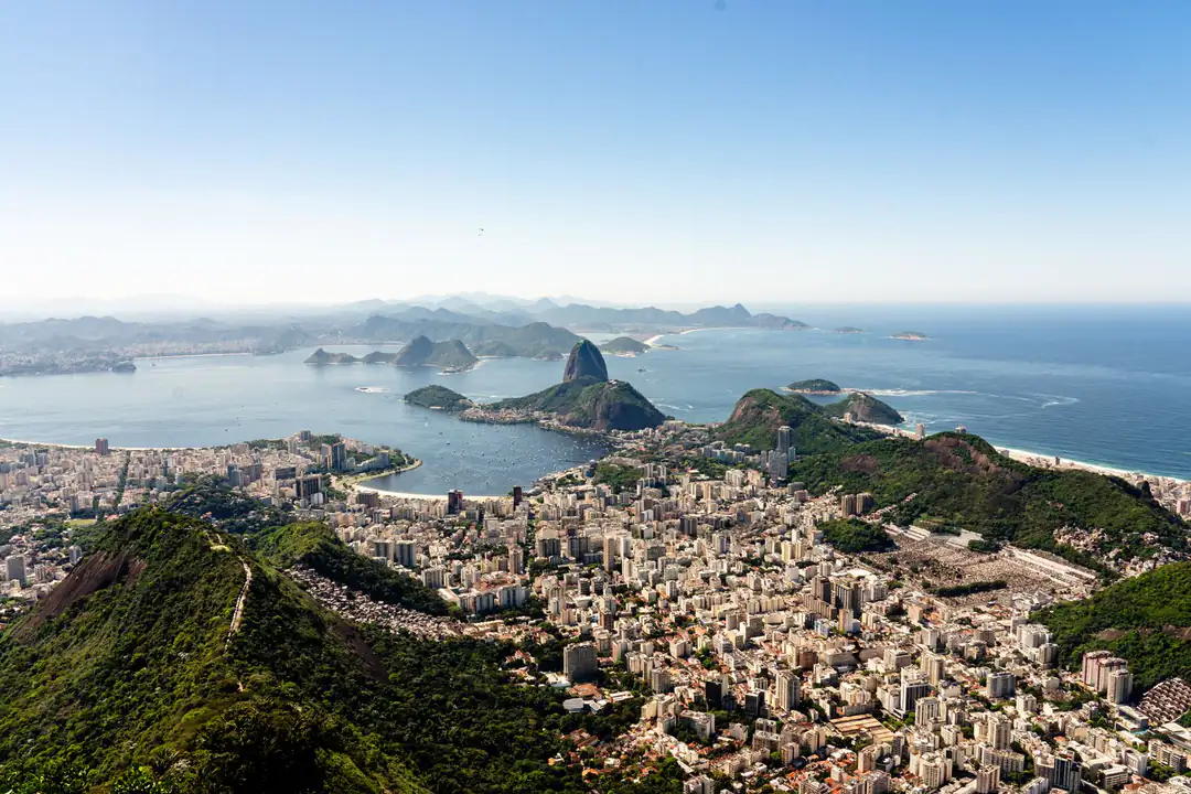
Rio makes much more sense once you understand its geography. On a map, beaches that seemed far apart suddenly sit next to one another, while two attractions that looked vaguely close can involve a mountain, a lagoon and half the city between them.
For trip planning, I divide Rio into a few useful areas rather than trying to memorise every neighborhood.
Where is Rio de Janeiro?
Rio de Janeiro is on Brazil's southeastern Atlantic coast. It is the capital of the state of Rio de Janeiro, but it is not the capital of Brazil. That title belongs to Brasília.
The city is built around an unusual mixture of ocean, bays, mountains, forest and lagoons. This is why routes that look short as the crow flies are not always short on the road. The crow, unfortunately, does not have to go around Sugarloaf Mountain.
Zona Sul
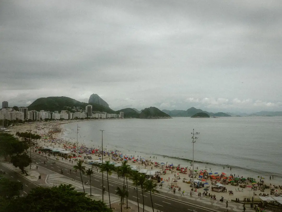
For most visitors, Zona Sul is the easiest area to understand first. This is where you find Copacabana, Ipanema, Leblon, Botafogo, Flamengo, Lagoa and Urca. Many of Rio's most recognisable images come from here.
Copacabana
Copacabana sits along its famous curved beach east of Ipanema. It has one of the largest concentrations of hotels in the city and makes a practical first-time base.
Ipanema
Continue west around Arpoador and you reach Ipanema. It is easy to walk between Ipanema, Arpoador and parts of Copacabana, which surprises visitors who imagined each beach as a separate destination.
Leblon
Leblon continues west from Ipanema. The beach remains, but the neighborhood tends to feel more residential.
Where are Christ the Redeemer and Sugarloaf?
Christ the Redeemer stands on Corcovado, inside Tijuca National Park. It rises inland above the Zona Sul rather than directly beside the beach. Sugarloaf Mountain sits at the entrance to Guanabara Bay beside Urca and Praia Vermelha. This explains why the two viewpoints offer such different perspectives of Rio.
Both belong on a first trip. Our things to do in Rio de Janeiro guide covers the major attractions in more detail.
Centro and Lapa
Travel north from the Zona Sul and you reach central Rio. Centro contains historic buildings, museums, offices and landmarks such as the Municipal Theatre. Nearby Lapa is known for the Arcos da Lapa, Selarón Steps and nightlife. Santa Teresa rises on the hills immediately above this part of town.
That makes Santa Teresa, Selarón and Lapa easy to group into the same day.
Barra da Tijuca
Barra lies much farther west. It has a long coastline, wide roads, shopping centers and a very different urban layout from Copacabana or Ipanema. There are good reasons to visit Barra, but I would not normally recommend it as the primary base for a first-time traveller who wants to sightsee every day. Distances become considerably larger.
Tijuca National Park
One of the strangest things about looking at a Rio de Janeiro tourist map is seeing just how much green appears inside the city. Tijuca National Park occupies a huge mountainous area between different urban districts.
Corcovado, Pedra Bonita, forest trails and several viewpoints lie within or around the park.
Rio's beaches on the map

From east to west around the main tourist coast, think roughly:
Leme, Copacabana, Arpoador, Ipanema and Leblon. Continue much farther west and you reach beaches around Barra da Tijuca and Recreio. Knowing this sequence makes planning beach days considerably easier.
You can walk between several of the Zona Sul beaches, although attempting to walk all the way to Barra because “it looked close on the map” is another matter entirely.
How to use Rio's map to plan your itinerary
Group attractions geographically. Spend one day around Copacabana, Ipanema and Arpoador. Combine Sugarloaf with Urca and Praia Vermelha. Visit Santa Teresa, Selarón Steps and Lapa together. Keep Tijuca activities together where possible.
This cuts down time in traffic and gives you more actual Rio for each day. Our Rio de Janeiro itinerary already organizes the main stops this way.
FAQ - Rio de Janeiro Map
Where is Rio de Janeiro on the world map?
Rio is on Brazil's southeastern Atlantic coast in South America.
What area of Rio should tourists stay in?
Copacabana and Ipanema are convenient for first-time visitors, while Leblon and Botafogo are also worth considering.
Are Copacabana and Ipanema close?
Yes. The neighborhoods are adjacent, with Arpoador between their main beach areas.
Where is Christ the Redeemer?
It stands on Corcovado Mountain within Tijuca National Park.
Is Rio easy to get around?
The main tourist areas are reasonably manageable using the metro, Uber, taxis and walking, but Rio's mountains and bays mean some journeys take longer than they appear on a map.
Which Rio neighbourhoods are closest to the main sights?
No single area is beside everything. Copacabana and Ipanema work for beaches, Botafogo is handy for transport, and Centro suits a more urban route.
How far apart are Christ the Redeemer and Sugarloaf?
They sit on different sides of the city. You can visit both in one day, but the journey and queues make separate days more relaxed when your trip allows it.
Is Barra da Tijuca close to central Rio?
No. Barra sits much farther west than the usual South Zone bases. Build in transport time before mixing a Barra stop with Centro or Santa Teresa.